Capital Improvement Project

Bevelhymer/Walnut Roundabout and Fieldhouse Detours

An overview the Bevelhymer/Walnut Roundabout and Fieldhouse related closures and detours.

Overview

As we move forward with the Bevelhymer Road & Walnut Street Roundabout Project, a new traffic pattern is required to accommodate the work. A detour route is now published below and will guide you around the construction site during the closure, beginning on September 2.

Thanks for your patience and support as we continue investing in New Albany’s future. 

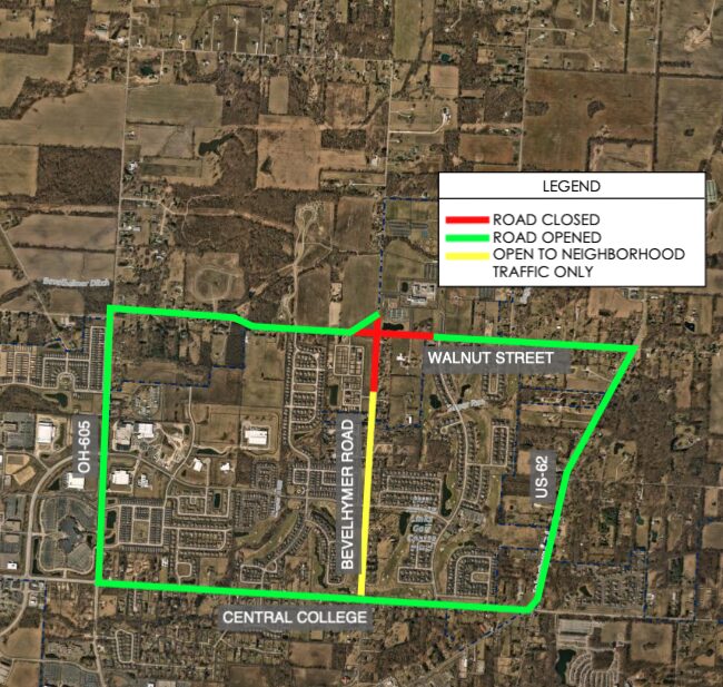
Aerial map highlighting road status with red lines for closed roads, green lines for open roads, and a yellow line for roads open to neighborhood traffic only, showing specific streets including Bevelhymer Road, Walnut Street, Central College, OH 605, and US 62 in a suburban area with residential and undeveloped land.

General Detour

August 4, 2025

The map is a guide to what roads are open, closed, or have restricted access.

  • Red Lines: These parts of the road are completely closed. You cannot drive on them at all. Though these areas are closed to the public, residents who live there will have full access to their homes via temporary access drives. In this map, the closure is at the intersection of Walnut Street and Bevelhymer Road.

  • Yellow Lines: These roads are only for neighborhood traffic. This means if you live in one of the neighborhoods along that road, you can use it to get to your home. But if you’re just trying to drive through the area, you should find a different route. Bevelhymer Road, south of Walnut Street, is a good example of this.

  • Green Lines: These roads are open as usual. You can drive on them freely. The large green box shows the main route you should take to get around the closed and restricted areas. It uses OH-605, Central College, and US-62.

In short, if you are driving in this area, you must use the large green-outlined route to get around the closed intersection of Walnut Street and Bevelhymer Road.

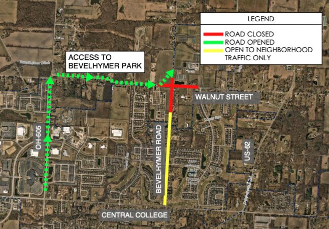
Aerial map showing road closures and openings near Bevelhymer Park with Walnut Street, Central College, US-62, and OH-605 labeled; red line indicates closed road on Bevelhymer Road, yellow line indicates road open to neighborhood traffic only, green dashed line shows open roads providing access to Bevelhymer Park.

Ball Field Access

An additional access road will be created.

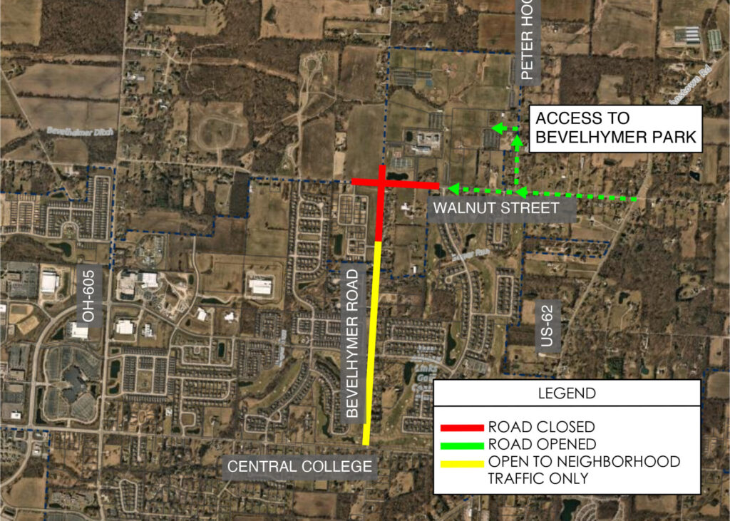
Getting to the ball fields will still be easy, even with the construction. A new, temporary access road has been created for visitors. To use it, please approach from the west side of Walnut Street and follow the signs. This will keep you safely away from the closed roads and the new roundabout under construction.

Pickleball Courts will remain open throughout the course of construction. More information on access will be provided ahead of the closure date

Aerial map of a suburban area showing Bevelhymer Road running north–south with a red cross at its intersection with Walnut Street indicating a road closure, a yellow segment south of the closure marked for neighborhood traffic only, green dashed arrows along Walnut Street showing open access to Bevelhymer Park, and a legend plus nearby labels like Central College, OH‑605 and US‑62.

Pickleball Access

Accessible from areas east of the pickleball complex

Located at 7300 Walnut St., our pickleball complex includes 16 tournament-level pickleball courts suitable for all skill levels. The pickleball parking lot will remain open during the roundabout project.

Pedestrian Traffic

Please exercise caution around closed areas.

Walking through the construction zones is strictly prohibited for your safety. Please follow the posted signs that indicate closed sidewalks and pathways.

Good news for walkers and bikers: the leisure trails along Walnut Street will stay open and are not affected by the roundabout construction.

Curving paved pathway lined with green grass and bordered by a white wooden fence and trees with bright autumn leaves in shades of yellow, orange, and red under warm sunlight.
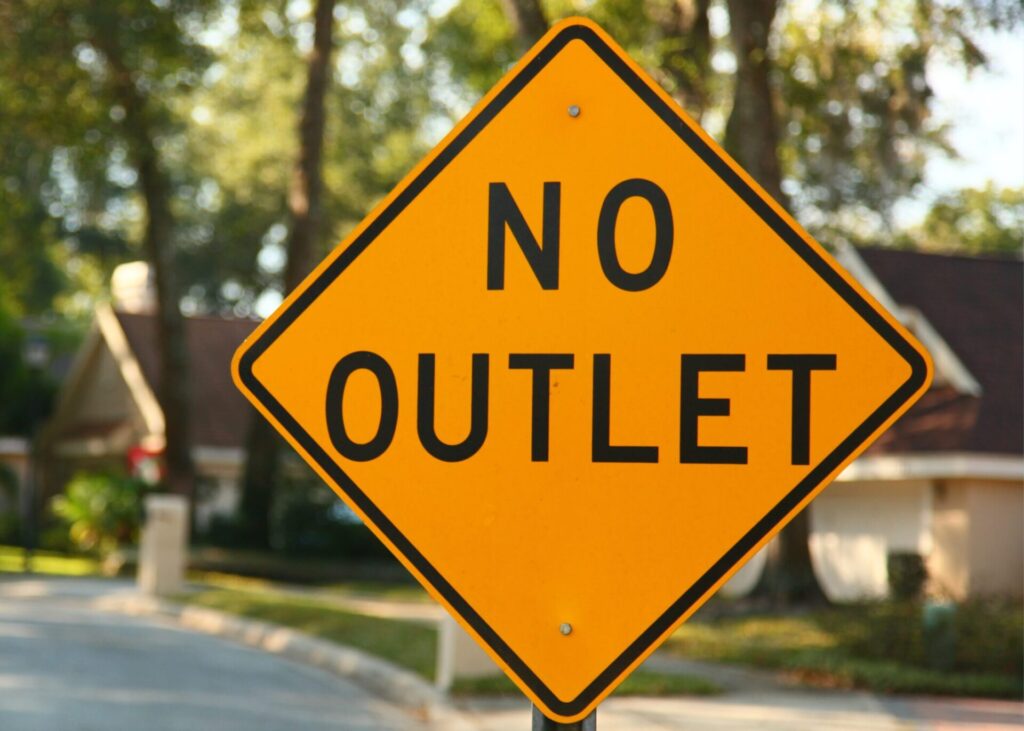
Yellow diamond-shaped traffic sign with black text reading No Outlet, set in a suburban neighborhood with trees and houses in the background.

Neighborhood Access

"No Outlet" signs will be in place.

To reduce traffic in local neighborhoods, “No Outlet” signs will be placed on potential “cut thru streets” along the route to encourage drivers to utilize the posted detour. These signs are a reminder that these streets are intended for residents only. If you do not live in one of these neighborhoods, please use the designated detour route. Residents will, of course, continue to have full access to their streets.

If you have any questions, comments, or concerns, please use the provided contact form.

Questions? Please provide them below.

Name(Required)
Email(Required)
Please let us know what's on your mind. Have a question for us? Ask away.